Google Maps has added a whole bunch of features that are powered by artificial intelligence, allowing you to more effectively reach your destination without getting lost.
While Google is all about providing a seamless experience that doesn’t require a lot of instruction, new features always have a bit of a learning curve. Fortunately, we’re here to help.
In this guide, you’ll learn exactly how to take advantage of these new Google Maps features, including Immersive View and Google Lens in Maps.
What Is Google Maps?
If you don’t know, Google Maps is the popular web mapping service from Google that provides directions to users, as well as a wide range of business information, traffic updates, and route planning.
In a blog post this week, Google announced a wide range of new AI-powered features that will make the service that much more impactful when it comes to planning your next trip, and we’ll go through each of them below.
 This just in! View
the top business tech deals for 2026 👨💻
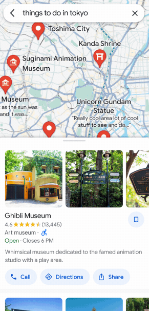
Immersive View for Routes
The Immersive View for Routes feature is a pretty cool one for those planning their routes with Google Maps. Rather than a standard map setup, this view will give you a realistic view of the buildings, scenery, and weather conditions you might see along the way.
This groundbreaking feature was announced in May 2022, and we haven’t gotten many updates since then. However, this week, the feature will be rolling out to select cities, so you can finally get the immersive view of your route in the Google Maps app on iOS and Android.
As for how, the process is fortunately quite simple. All you have to do is set up your route like you always do. Then, instead of the street view window, you’ll find it has been replaced by the Immersive View window in the bottom left corner of the screen. Once you click on that, you’ll be taken to the route preview, which will take you to the new interface.
Take note, the Immersive View for Routes feature is not widely available to all users just yet. You’ll have to be in one of the cities that have already rolled it out, which includes Amsterdam, Berlin, Dublin, Florence, Las Vegas, London, Los Angeles, New York, Miami, Paris, Seattle, San Francisco, San Jose, Tokyo, and Venice. The feature will be coming to more cities soon, though, so be patient and you’ll be getting in-depth directions in no time.
Immersive View for routes in action
Image: Google
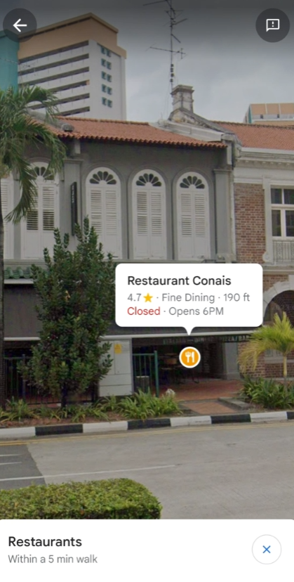
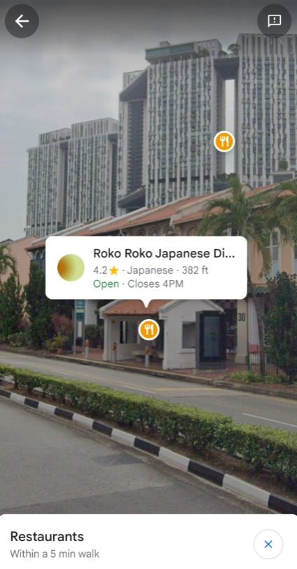
Google Lens in Maps
Lens is the image recognition technology offered by Google, which allows you to take a picture of a particular item and it can tell you what it is, within a reasonable doubt. However, the technology hasn’t been available on Google Maps… until now.
Google Lens in Maps is a helpful and effective tool for understanding your surroundings a bit better. It uses image recognition technology to show you exactly where your destination is with Google Map indicators displayed on top of your in-person camera view.
Again, this feature is quite easy to use once you know where to look. In your basic view of Google Maps, look up at the search bar at the top of the screen. Click the Google Lens icon (a small camera), which should be next to the microphone icon. This will open your camera up, giving you the option to choose what kind of establishment you’re looking for (restaurant, bar, salon, etc.). The screen will then display all of locations within your parameters when you point your camera in that direction.


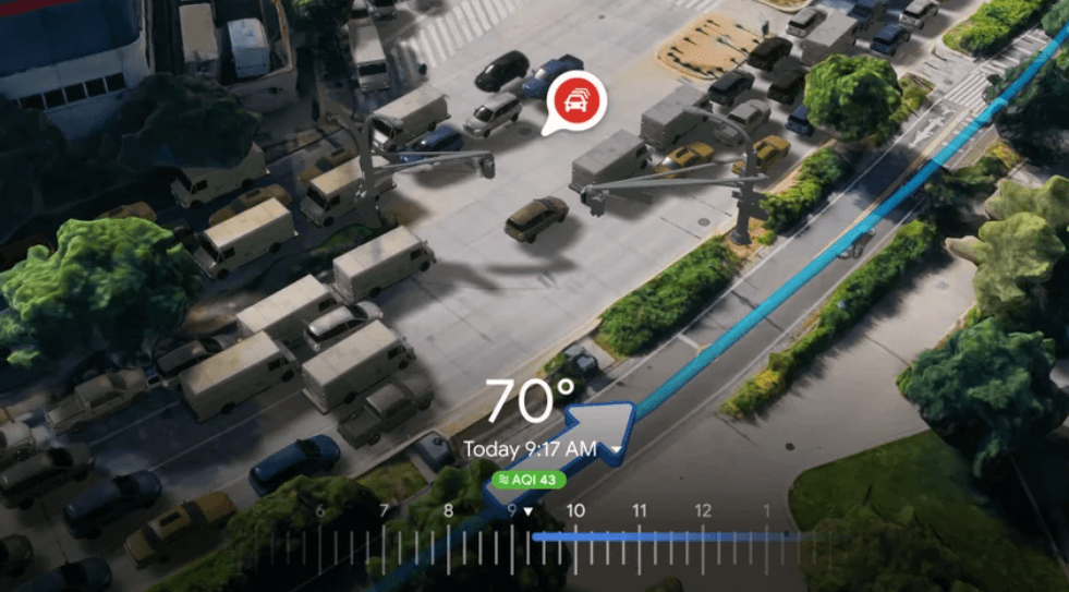
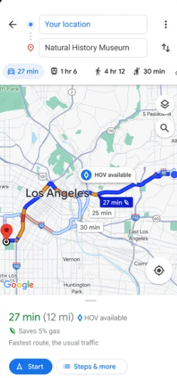
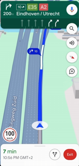
Detailed Map Functionality
While this isn’t necessarily a new feature, it does provide a convenient update that will make driving in particular that much easier. After all, new features aren’t helpful if the basic Google Maps interface doesn’t work for you. In this new update, the Google Maps interface gets a substantial improvement, allowing for in-depth map details that can help you along your route.
More specifically, Google Maps will now alert US drivers when an HOV (carpool) lane is available on the way to their destination. For European users, AI-powered speed limit information will now be available directly on screen, so you can see if your kilometers are getting to dangerous new heights.
Fortunately, you don’t have to do anything to utilize these new features. Just make sure you have the updated version of the app and that you’re living in a city that has rolled out these features, then keep an eye out for these new features on your next trip.
Improved EV Charging Information
Electric vehicles are a sustainable and environmentally friendly way to get around your city. However, unless you have a charging dock at home, you’ll have to find a charging station to fill up your ride, and they aren’t as easy to find as the nearest gas station. Fortunately, Google Maps just changed that.
With this new feature, electric vehicle drivers will be able to get detailed information about EV charging stations near them. Not just location either; you’ll be able to see what kind of charging stations are available and how fast they can charge your vehicle.
To utilize this handy feature, you don’t have to put much work in. Simply search for charging stations on Google Maps, and you’ll see a selection of options pop up, just like if you were searching for a bar or restaurant. Then, just scroll up from the bottom, and you’ll be privileged to all the new information you need to get your car charged up fast.
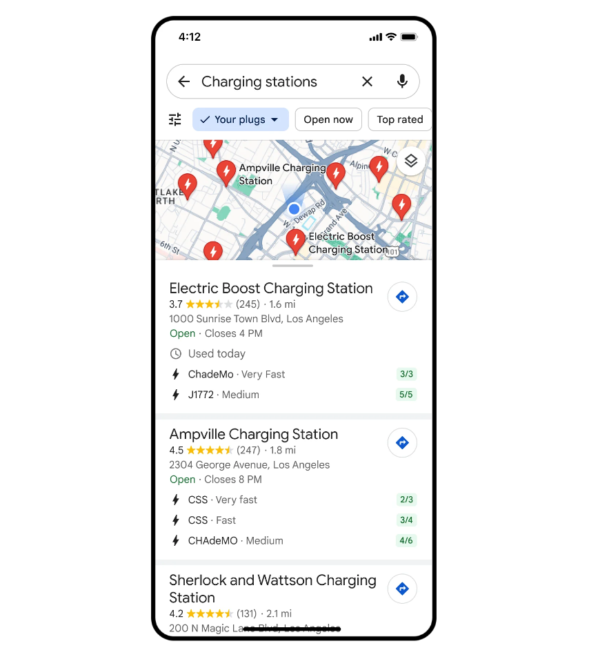
Image-First Results in Google Maps Search
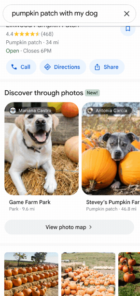
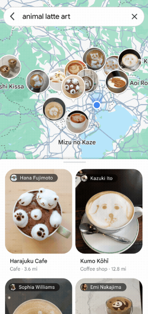
Being a visual learner means that your brain is more attuned to seeing images than reading words when looking for something in particular. With Google Maps, these kinds of learners are going to be able to find what they’re looking for a lot faster thanks to image-focused search in Google Maps.
This new update (again, not necessarily a feature) will allow users to do a bit more visual digging for their particular destination. The image-first search results for queries like “animal latte art” or “pumpkin patch with my dog” will bring up images when you scroll up and even show specific images on the map icons.
Again, you don’t have to do much to take advantage of this feature. Just make a search in Google Maps that requires a bit more visual focus, and scroll up from the bottom of the screen to see more images and views that coordinate with your search.